
Patrick McGranaghan is a land surveyor in Denver, Colorado. He started the MapPorn subreddit in May 2011 while living in Taipei, Taiwan. In his free time Patrick is a geographic pilgrim, visiting places like the Mason-Dixon line and all seven corners of Colorado. Patrick also runs the Twitter account @mapporntweet.
Patrick was interviewed for GeoHipster by Ana Leticia Ma.
Q: How did your career as a land surveyor come about?
A: I found a job working as a rodman for a surveying crew after doing a stint teaching English to school children in Taiwan. Living in Taiwan was one of the best experiences in my life, but after four years it was time to come back. When I got back I had few connections or prospects, but knew I wanted to do something with maps, so I applied for a surveying job that I found on Craigslist. After several years of learning on the job I was able to move into my dream job of drawing survey maps for a living.
Q: The 10th anniversary of /r/MapPorn is coming up. Tell me what inspired you to start MapPorn, and what goes on behind the scenes.
A: I joined the Reddit community early on because I liked the interface and the up-vote and down-vote style of finding content. When I started /r/MapPorn the ‘subreddit’ communities were still a new idea and there wasn’t one for high-quality maps. I can remember in the years of the 2000s trying to search for good maps and the content was much harder to find. There were a few sites like the David Rumsey Map Collection and Frank Jacobs had a great blog called Strange Maps but other than that there were few sites that collected the kind of maps I was interested in.
In the years since Reddit and the user-base has transformed. Reddit was originally for desktop users who could look at content on a big screen with a reliable internet connection. Now, for better or worse, the majority of users are on mobile. I think this biases the content in favor of bite-sized consumable maps that look good on a phone or tablet device. Purists sometimes find these ‘meme’ style maps to be irritating, but the demographic trends are inexorable.
Q: Are you a map hoarder?
A: Yes, map hoarding is definitely a problem for us in the hobby. Any time I’m traveling I can’t resist picking up free brochures or other ephemera with a map. I have boxes in my closet full of such souvenirs and memorabilia. I’m used to moving around and traveling so I probably have a smaller collection than a lot of hobbyists to keep things light. Almost the entirety of my bedroom walls are covered in maps and illustrations. I recently visited a great little map store here in Denver called The Old Map Gallery, and I had to pinch myself and think about my crowded walls to stop myself from buying more maps. Map collecting is sometimes surprisingly affordable and antique maps can be had for less than a night at a nice restaurant.
Q: What kind of maps would you like to see more of?
A: I think that there is still a lot of potential in maps with modern data visualization techniques. We have an ocean of data in this age and I think a lot of it is lost in databases, csvs, xml and other data structures. I like maps that connect disparate datasets in novel ways and make new discoveries. In the book “Info We Trust” RJ Andrews has a chapter visualizing the orientation of cathedrals and showing how they are oriented towards the rising sun. This is the kind of insight that new maps can show. The data is already out there, it just takes a clever person to connect the dots.
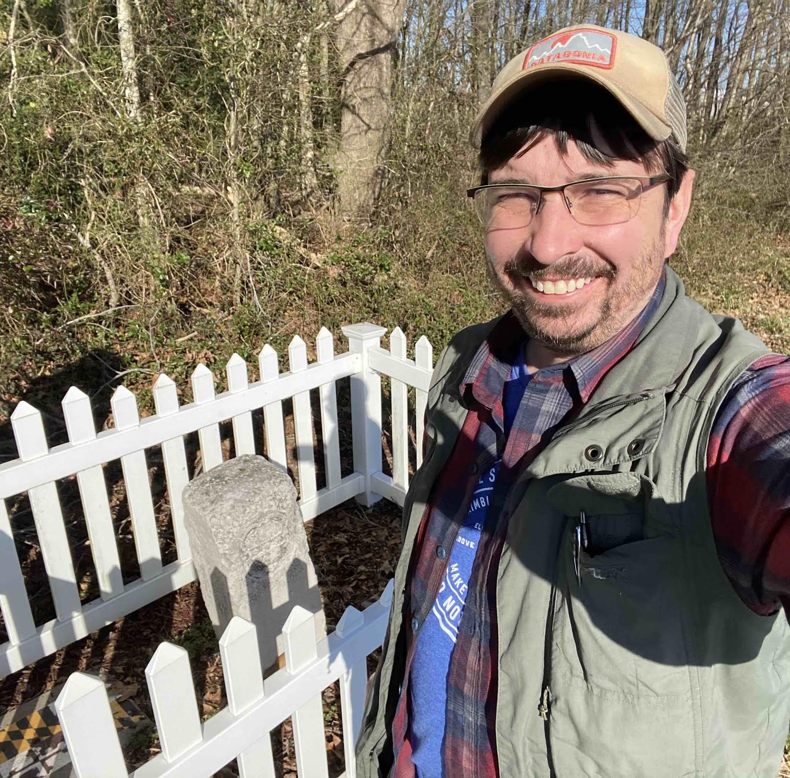
Q: You’re one of the biggest geo nerds I know. What are some of your geo-related hobbies?
A: Thanks, I’m flattered. In the words of Thomas Pynchon from Mason & Dixon, I would consider myself to be a “Geometrickal Pilgrim”. In 2020 I finished my goal of visiting all seven corners of Colorado. Yes, seven corners if you include the points where other states have their corners on the Colorado line. I also recently made a trip to the Philadelphia area to visit the Delaware “Wedge” and other sites associated with Mason and Dixon. A few years ago I hiked along Hadrian’s Wall in northern England.
I also like to make maps using QGIS and Illustrator. Recently I’ve been exploring different projections. I’ve been especially interested in the Hotine Oblique and the Gnomonic projections and in how they challenge conventional ideas of the flat map.
Q: When we met at NACIS in Tacoma, you told me you’ve spent a lot of time traveling. How many countries have you been to, and what are some of your future destinations?
A: Yes, that was a great NACIS convention! Unfortunately we’ve all had to put our travel plans on hold in the last year. I had planned on doing a Round the World trip in 2020 but obviously that fell through. Some of the places I hoped to visit on that trip include a huge map of Korea in Daejeon, a Soviet map store in Latvia, a giant map on a cooling tower of a power plant near Meppen, Germany, the home of Dutch astronomer Willebrord Snell in Leiden, and Roy’s baseline near Heathrow in England.
As far as countries I’ve been to, I don’t really keep count, but it’s around 30. Here’s to hoping things get back to normal soon. We’ve only got a limited time on this planet and we’re losing years of our lives that we won’t get back.
Q: Any final words to our GeoHipster readers?
A: I just want to say I love my GeoHipster calendar, shoutout to Barry Rowlingson for his April Fools’ San Serriffe map.
Leave a Reply