
Anton Thomas is an artist-cartographer from New Zealand, based in Australia. He creates hand-drawn illustrated maps with colour pencil and pen. His focus is primarily on large works which showcase the world in heavy detail and vivid colour. His works include North America: Portrait of a Continent, a map that took almost five years to complete.
Anton was interviewed for GeoHipster by Ana Leticia Ma.
Q: How did your journey as a cartographer begin?
A: I was obsessed with maps as a young child. Growing up in small-town New Zealand, my surroundings were awe-inspiring. The geography of the South Island is magnificent, and maps helped me understand it. Exploring them evoked mystery and adventure. While I did like fantasy fiction, I found the real world to be far more captivating. And New Zealand has the geography for it: one looks across the ocean to snow-capped volcanoes, while the Pacific crashes into primeval coastline. It was a vivid place to grow up.
NZ is also very isolated, so perusing atlases and globes was a way to explore distant lands. I would stay up at night drawing maps, committing coastlines to memory. I also loved drawing animals, landscapes, cities, dinosaurs – whatever interested me – and I combined these with maps from the start.
This passion was somewhat neglected through my teens, but came roaring back when I began travelling in 2011. After a childhood in NZ, I was amazed at the vastness of continental geography. I spent two years criss-crossing North America, and my love of maps was reignited. I began to draw them more than ever, culminating in my Portrait of a Continent project (discussed in Question 3).
Q: You’re working on a map called Wild World. Can you tell me more about it?
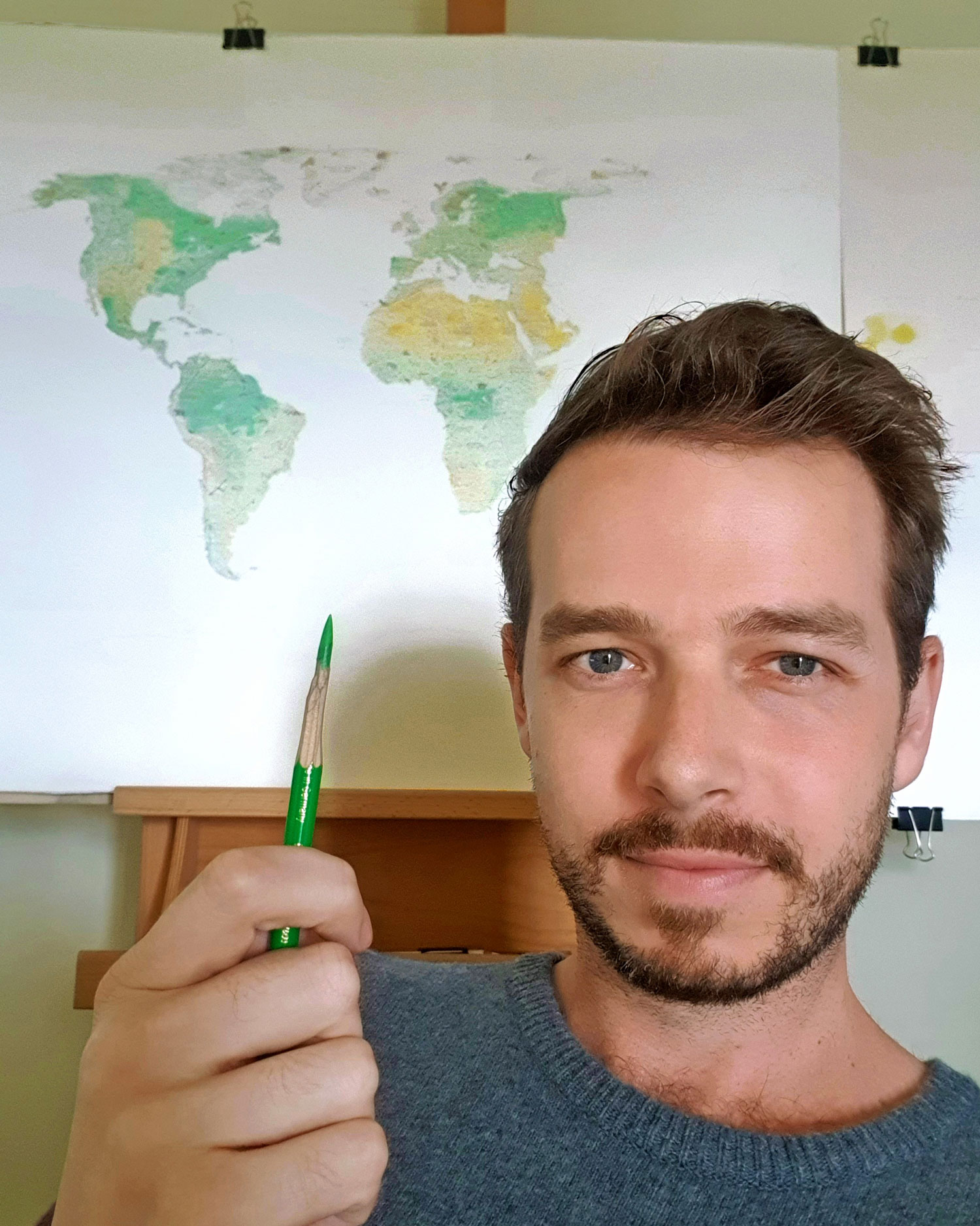
A: I started Wild World last year, in the middle of a long lockdown in Melbourne. After years drawing a map of North America, I was desperate for something different. I wished to focus only on the natural world, instead of the countless skylines and cultural features of my previous works.
So, it is a world map about nature. The map is in the lovely Natural Earth projection, centred on 11°E rather than Greenwich (I prefer the edges to cut through the Bering Strait, unlike 0°). After sizing it, I printed off the base map and stapled it to the back of my art paper. Then using a lightbox, I traced all coastlines, rivers, and relief and began drawing.
I’ve dreamed of this map since childhood. At age 15 I drew a world map in which the coastlines are shaped by animals of each region. More recently, after seeing Tom Patterson’s stunning physical world maps, I envisioned an animal map showcasing physical geography in detail. Painstaking attention is given to geography and labelling, as I hope it can be a great reference map for world geography. Meanwhile, animals are amazing at evoking place (think tiger in India, kangaroo in Australia), and evoking place is a key goal of my work. There have been many animal pictorial maps through the ages, but they often have a cartoonish character. The illustrations can feel separate from the map, stamped on top like clipart. There are some great maps in this style, but I like to bake my illustrations into the geography, so everything flows together. I want my baboon wandering the mountains, not pasted over the top.
I include no extinct, introduced, or domesticated animals. Only native extant fauna (also no cryptids. Sorry, sasquatch enthusiasts). So Wild World does present Earth in an idealised fashion – although civilization’s footprint can still be seen (e.g. the current extent of the Amazon or the Aral Sea). By showcasing the majesty of Earth’s natural heritage, I hope it can inspire people to consider its importance – and its profound fragility.
Finally, I needed to move on from the North America project. After years on that one map, I’m putting all I learned into something new. Experimenting with new ideas, and (hopefully) proving not everything I draw takes years! I hope to finish and release prints in late 2021. You can sign up to be notified at www.antonthomasart.com/wild-world
Q: It’s wild how you spent 5 years working on your map North America: Portrait of a Continent. How did that project come about? Did you ever think about giving up in those 5 years?
A: In 2012, while living in Montréal, I drew a map of North America on a refrigerator. The fridge was old and covered in rust stains, so my housemate painted it white. Looking at the bright new surface, he asked me to draw something to liven it up.
At this point I’d been backpacking the continent for two years, working as a cook, a labourer, turfing lawns, busking… whatever kept me moving. I had grown obsessed with the geography I saw. Visions of a grand map consumed me, one that would showcase that vastness – filled with skylines, landscapes, and animals. So, in a creative frenzy, I used the fridge to test this idea.
Fast-forward to 2014, and I was living in Melbourne, Australia. After the fridge I’d drawn a large map called South Asia & Australasia, this time with colour pencils (on paper, not a fridge). This gave me the experience required to draw North America properly. I thought it might take six months, but as the map progressed so did my skills. The detail became increasingly refined. The research became more in-depth. It was all done in my spare time (nights, weekends), as I maintained a day-job to pay the bills. It was an astounding amount of work, compounded by constant re-drawing due to my technical improvement. In the end, I completed the map in early 2019: almost five years later!
The odyssey hijacked my life but giving up never crossed my mind. I loved drawing it; the map offered me meaning and direction at a difficult time. Midway through the project I attended the NACIS conference in Colorado Springs (2016), meeting a wonderful cartography community for the first time. The map was well-received, and this was a crucial boost. What I learned at NACIS was revelatory, while the response to my map hardened my resolve to finish it.
Q: Can you walk me through the process of drawing each geographical area, especially for areas that you have never physically visited or seen?
A: Everything starts with research. When I get to a new region, I read all I can about it. I do so in stages, starting with physical geography. I must get a sense of where the mountains, plains, forests, deserts, and rivers are. I open new tabs on anything intriguing and follow the breadcrumbs.
Then, I move past physical geography. In the case of North America, there was a huge layer of cultural research. Where are the cities? What are the iconic landmarks? I read about the history, economy, sports, arts, flora, fauna and more. I am always searching for that which would be familiar to a local.
In the case of Wild World, I bypass much of this stage and go straight to animals. What are the apex predators? What are the most famous animals in the region? Animals are often used in regional iconography (e.g., New Zealand’s kiwi), what are these? I look across the animal kingdom – mammals, birds, reptiles, fish etc. I check national parks and nature reserves, as they preserve wildlife populations and have plenty of information available.
This is all done online, and everything I draw is cross-referenced. You cannot count on Wikipedia for everything. If it is suggested that the national bird of Angola is the red-crested turaco, I need more than just a sentence without citation. I look out for local sources, hashtags on Instagram that may be leads, even checking Angolan government and tourism websites.
While researching, I mark off ideas in pencil on the map. I pin important locations on Google Earth, such as mountain peaks or national parks. Once I’ve learned enough, I can see the artwork in my mind. I ink in the labels, grab my pencil, and begin sketching.
Q: Is there an artist, philosopher, or cartographer that you get inspiration from?
A: Heinrich Berann’s painted panoramas are legendary. His map of Yellowstone had a big impact on me. The way in which it is both landscape art and a map, without concern for fitting into either category, is wonderful. I think these categories can be confusing anyway – most cartographers are visual artists too. Berann’s work feels unbothered by such distinctions, and his maps are magnificent.
Many in other fields have been inspirations on my maps. Ernest Hemingway, Nina Simone, Jimi Hendrix, and Ibrahim Gonzales (of Buena Vista Social Club fame) come to mind. Jack Kerouac’s descriptions of American geography were very influential. Creative inspiration is not field-specific, everything in life flows together to inspire what you do.
Q: You made a world map with dried peas at NACIS Tacoma. Aside from that, what’s the weirdest thing you’ve used to make a map?
A: Ah, that was fun! Well, I made a map of New Zealand by cutting up a pair of jandals (“flip flops” as they’re known in the States), a map of Australia with vegemite smeared on toast, and a cat fur world map after a friend groomed their fluffy cat (the only map that ever made me sneeze).
Most recently, while on holiday in Tasmania, I drew a map of Tas in the sand every time I was on a beach. Early on, the map wasn’t great due to my unfamiliarity with the island. But as my trip progressed, the maps improved as I filled in my knowledge. I drew them on beaches in the north, south, east and west – even on sandy riverbanks in the interior.
Q: I really enjoyed your jamming sessions at the NACIS virtual event. What kind of music do you like to play? Do you listen to music when you’re drawing?
A: It was so fun to play some music with my fellow cartographer/musicians at NACIS! Hopefully it’ll be in person one day. I play guitar and sing, predominantly blues and soul. I listen to a lot of music while drawing, and often like to explore music from the region I’m mapping. This method helps you to feel immersed in the place at hand – especially important when you can’t travel there. Music is a most powerful expression and reflection of place. Ask yourself, what does a place sound like? With this, you begin to approach the beating heart of a region, a culture, a spiritual channel that transcends language.
Plus, music mapping is a great way to discover new music! Music that you may never come across otherwise.
Q: What’s your life philosophy, and what advice do you give to our GeoHipster readers?
A: I feel at my core I try to remember life – and this planet in which it unfolds – is filled with wonder and adventure. It’s more vast, beautiful and terrifying than any fantasy world in fiction. Certainly, in ways it is also a tragedy, and that is a burden and a puzzle. But our mere presence itself is extraordinary, and an appreciation for the vastness of the Earth helps one to consider that broader picture. To move beyond yourself. It’s why I hike, it’s why I explore music, it’s why I love maps. I don’t want to ever forget how amazing this life is, no matter how precarious things can seem.
As for maps, I would just say… try to make maps that interest you. Follow the path that your curiosity urges. If you’re having fun with it, it will be easier to remain passionate and work hard, thus acquiring the requisite hours to get better and better.
Q: What does being a geohipster mean to you?
A: In all honesty I’m not quite sure, except to say I think I was a geohipster “before it was cool” (as any good hipster activity should be)? Referring to my Montréal fridge days, circa 2012 I was a 22-year-old bike-riding line cook trying to speak French (badly), who would return to my houseplant-filled apartment in La Petite-Italie to drink Québécois beer and draw a map on my refrigerator. Hopefully I acquired enduring geohipster creds from this!
Q: Where can we purchase your beautiful maps?
A: Prints of my maps are available at www.antonthomasart.com – shipping worldwide. The North America map is currently available, and Wild World prints should be ready later in 2021. You can subscribe to be notified when it’s available at: www.antonthomasart.com/wild-world
Leave a Reply