
Tell Us About Yourself:
My name is Euan Mitchell and I am a geospatial professional in Edinburgh, Scotland. I have a PhD in geology and worked as a college professor in the United States for several years, before changing careers and returning to my hometown of Edinburgh about four years ago. That led to an MSc in Earth Observation from the University of Edinburgh in 2021, and I currently work as a geospatial Data Scientist for Space Intelligence, a small but growing company here providing nature data in support of forest protection and restoration projects.
My main day job involves producing high resolution and accuracy forest biomass maps, through a combination of machine learning and satellite data, including data from NASA’s GEDI lidar instrument, which was the subject of my MSc dissertation at Edinburgh.
I am on Mastodon (@MindOverMagma@mapstodon.space), LinkedIn (https://www.linkedin.com/in/euan-mitchell-2b4256198/), and have a small website at www.euanmitchellgis.com.
Tell us the story behind your map:
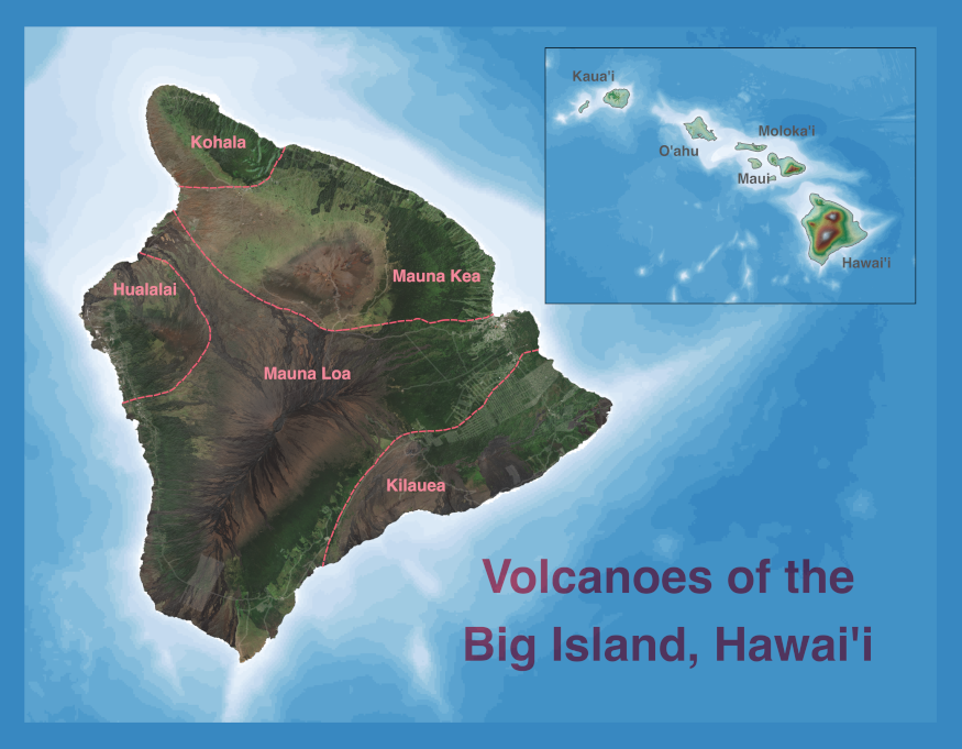
This map originated as a submission for the 30DayMapChallenge in 2022, when I somewhat unintentionally completed the challenge, having only intended to make a handful of maps. This was my map for the theme of ‘Islands’, and, having become aware of the GeoHipster calendar at the same time, I resolved to submit something next time around. I improved the map a bit and submitted it last year.
It is also a bit of a bridge between my past and current careers. When I was working as a geologist my main interest and speciality was volcanology, and I was fortunate enough to teach a field course on the Big Island of Hawai’i in 2016. My geospatial journey began with a series of courses on Coursera, and the first independent project I worked on as part of that involved attempting (not particularly successfully to be honest) to estimate, using satellite data, the area impacted by the eruption around Puna in 2018. My current job involves working with satellite data on a daily basis, including Sentinel-2 data that are the basis of the map.
Tell is about the Tools, data, etc., that you used to make the map:
The heart of the map is a cloudless mosaic of Sentinel-2 imagery from the European Space Agency, processed in Google Earth Engine. This is overlain semi-transparently over a hillshade layer derived from elevation data from the United States Geological Survey. The additional details, such as roads and volcano boundaries, that are overlain come from the State of Hawai’i GIS Program. The background is the GEBCO bathymetry dataset and the whole map was created in QGIS.
Leave a Reply