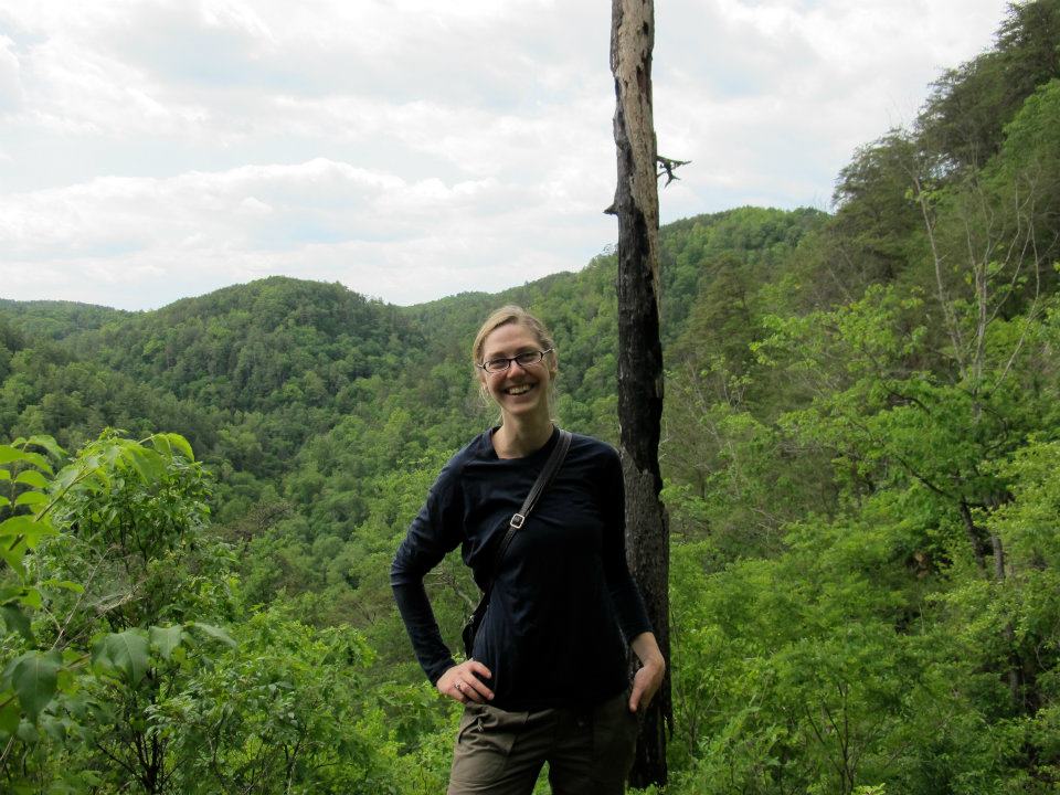
Sunny Fleming is Esri’s industry lead for public sector environment. Throughout her career, she has applied GIS concepts and technology to environmental policy, conservation, and natural resources; from monitoring species in the field to helping state parks manage assets and assess their economic impacts. She continues to pursue her passion for the environment by helping industry leaders streamline and improve their work with GIS technology, whether in the field or in the office, and whether setting policy or managing wildlife and resources. Her academic background is in botany and plant ecology, being a proud graduate of UT Chattanooga. She’s chased lemurs in Madagascar trying to collect their poop, repelled into sinkholes in Appalachia to count ferns, and scrambled shale cliff faces that hadn’t been explored since the 1800’s. She resides in Nashville, TN with her husband Chris- an environmental consultant – and their two dogs Elsie and Alex.
Q. First off – Where are you located on earth?
Where am I at? Nowhere and everywhere! Or, for practical purposes, Nashville, TN
Q. What do you do?
What do I do? I think of my job as a link between Esri and the environmental “industry.” My communication and role goes both ways: I at once advocate internally at Esri on behalf of our environmental community to ensure that our products and solutions are meeting the challenges they’re tasked with, while also helping the environmental community fulfill their full potential with the tools and have a vision for where we can take our industry and how geospatial will help us get there. This is precisely why I find the time we’re living in so interesting… are we on the precipice of complete disaster? Sure. But I remain really optimistic because I feel like “I’ve seen the future” and that future is a world where we fully recognize the interconnectedness of our natural, cultural and economic systems, have the spatial tools that give us insight like no other technology can and actually help us adapt and avoid the worst of what we’re facing. I think the Infrastructure Bill, domestically, is fascinating and concrete evidence (and symptom) of what is a global “enlightenment” on this topic.
Q. The ESRI user conference was back this year in person. How was that after a couple of years off and everything being virtual?
Virtual has its own kind of perks, but it also has its downsides. For the past two years as virtual, my husband and I would set up the plenary on our TV and sit on the couch and watch it. #upside. On the other hand, we were still having to respond to emails, messages, etc and it was much easier to be distracted. #downside But there’s something more that’s a little more difficult to verbalize about being in person – there is an innate energy about being gathered together with 15000+ people who share a common language and interest. It can move one to tears and I do get emotional about it every time I’ve been to the UC.
This year for me was especially poignant. I was hired to Esri in late 2019, so I’ve never supported our UC in person as an employee. I was also formerly a Solution Engineer and by the time we were back in person I had moved into Industry Marketing. Our Industry Marketing team plays a functional role in regards to curating the experience our users have at the UC. So I felt a lot of pressure this year on top of being very excited. I wanted to make sure that the messaging we were putting forward around Environment in State and Local Government felt relevant to our audience and was inspiring for them… until you put that messaging out there, you don’t really know if you “got it.” It can be a little terrifying and I had some sleepless nights leading up to it where I was second guessing myself. I had a team of Solution Engineers and Professional Services to support me and I couldn’t have asked for a better team – they tolerated my anxiety with grace and kindness and put together some fantastic demos for our kiosks.
We’ve had a lot to be cynical about the past couple of years – generally speaking. For me, the User Conference always dispels the patina of negativity that can accumulate over time. Being in person this year was a much-needed respite. It just makes me HAPPY to be there, and this year especially – we had so many attendees that were first timers! There was an energy and optimism that can’t be matched in a virtual environment. It’s given me a lot of ideas and inspiration, personally. I genuinely love my coworkers, love the company and love the user group. It’s hard to be away from them for so long.
Q. You become President of TNGIC this year. Madame President (If I can call you that) – what is TNGIC? Here’s the hard question – do we need GIS specific user groups in 2022?
I totally call myself Madame President! I’m unsure how many opportunities in my life I’ll have to be able to say that, so YOLO! TNGIC is Tennessee’s organization for GIS professionals and it has really stood the test of time – which means that there’s a responsibility on my shoulders to ensure that we continue being a healthy and relevant organization.
To the second question, but related to the above – professional GIS organizations SHOULD be more important now that ever and I think that’s the challenge we’re up against. So many professional groups for GIS organizations consist of those who are in government and TNGIC is the same. However, the application of this toolset we call GIS is ubiquitous to every industry and we need to figure out how to branch out our network to include these industries. Our professional organizations should be growing at the same pace as the GIS industry but right now my sense is that’s not happening.
I do think we still need specific user groups – these need to be both industry specific, but also technology specific. It’s like picking up a copy of Woodworking Magazine! You can be a woodworker (a GIS user), but focus on specific applications of those tools (furniture, sculpture, etc.) We all still want to pick up a copy of that magazine though and read what others are doing, be inspired and apply it in our own ways. “A rising tide raises all boats.”
Another goal of mine is to ensure that TNGIC begins to outreach to non-GIS users on the value of GIS. As an industry, this is something that’s been historically difficult for us. We love the technology, so we tend to speak to the technology first. We need to learn how to speak to the challenge it solves first and remember that those in leadership positions don’t care if it’s GIS or something else – they just want to know they can solve the problems that keep them up at night. I only have a year as Madame President and I have lofty goals. Our board is up for the challenge though, and we know that the first thing we need to do is take a hard look at how we conduct business in order to set ourselves up for a future where our processes can support our vision.
Q. We had a conversation at the last TNGIC Meeting – how did you get started in GIS?
Ah yes! Before I was a biology major, and before I had ever touched GIS, I was an art student. This allowed me to get my hands dirty with things like Adobe Photoshop and Illustrator – both applications use the concept of “layers” and various algorithms to manipulate the scene. Later, when I found myself in the position of being a biology intern at Arnold Air Force Base, I had an opportunity one day to take an Esri module. This was before we had our entire learn catalog and suite of tutorials as many know it now.
There was a stormy day and our office had to figure out some way to keep the interns busy and out of the way, so we all got setup on this Esri module. With my art background, the software was really intuitive for me and so I quickly deviated from the goal of the lesson and began exploring the tools. This resulted in a hot pink trail map with black-and-white dashed trail lines and little skulls for waypoints. It was very Sex Pistols punk rock!
I didn’t touch the software for another couple of years until later, when I was a biology student at UT Chattanooga. I found myself hired onto a grant that Dr. Shaw and Dr. Estes (APSU) had secured to map the ecological systems and rare species of the Ocoee River Gorge. This was a massive project – we were subcontracted by URS and our stakeholders were TVA, USFS, USFWS, State of TN and others. Our deliverable was GIS. While I was hired pretty much just to press plants and go on coffee runs, I had this sense that if we didn’t tackle the GIS from the beginning, we’d be stuck translating tons of data on the backend. I naively offered my services to tackle the GIS as our “Plan B.” My punk rock map had not prepared me for the breadth and depth of this software and I quickly became obsessed with teaching myself these tools. They were SO POWERFUL! I had never felt quite so empowered in my life. I scaled back my class hours to part time and pretty much lived in our lab teaching myself this software. We used it to plan our field work, to track our collections and then of course we used it to translate our findings into a spatial deliverable. There was no Web GIS at the time – just desktop. I fell in love with it, but also it allowed me to gain a reputation for myself. Dr. Shaw and Dr. Estes were hugely supportive and they trusted me to network with conservation leaders in TN. I remember vividly how they included me in some very important meetings despite being “just an undergrad.” The result was that I was hired immediately out of undergrad to the State of Tennessee – a relief for someone who was not a classically “good student” on paper in the middle of a recession.
Q. Best Park In Tennessee for viewing wildflowers?
Oof – this is the toughest question!
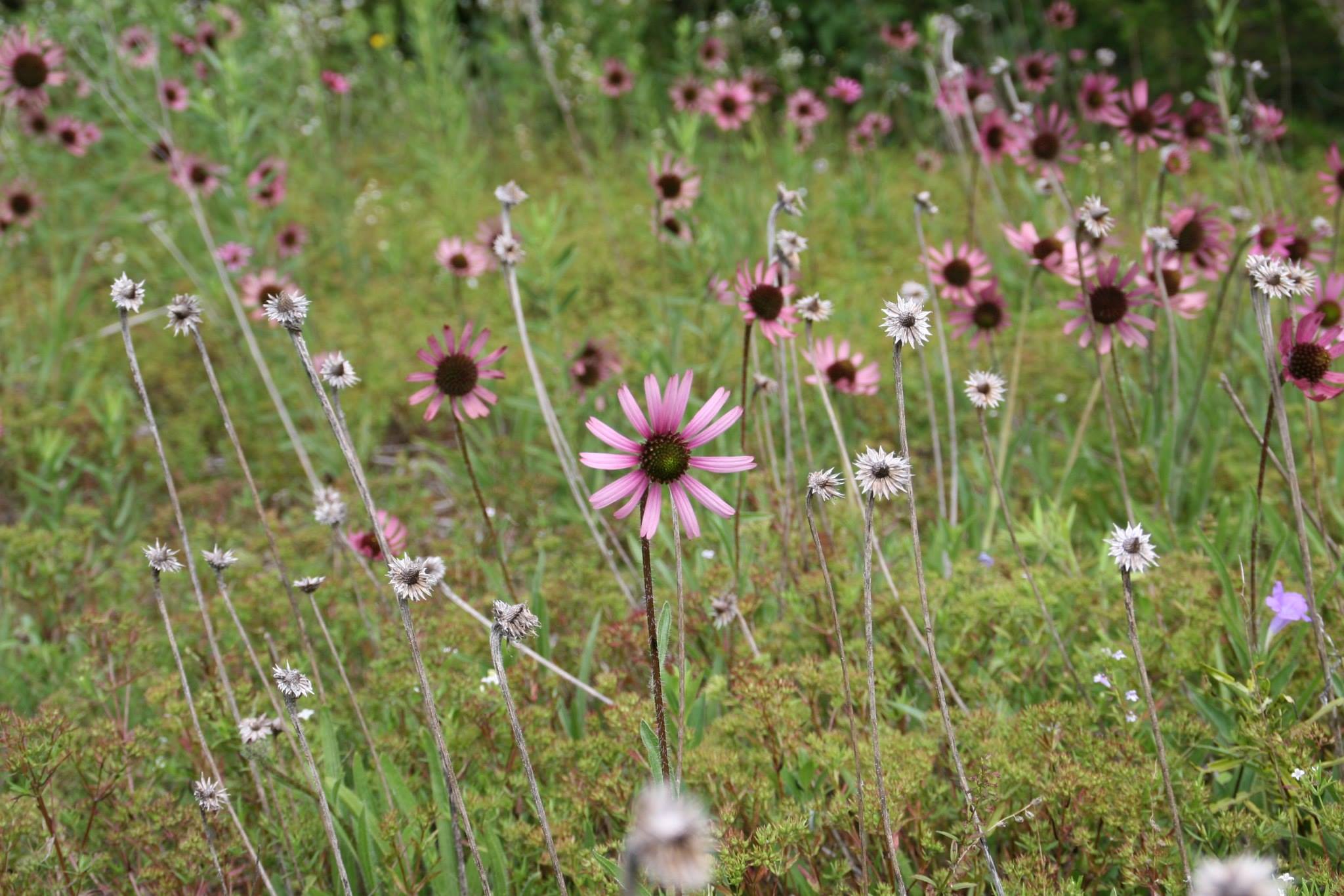
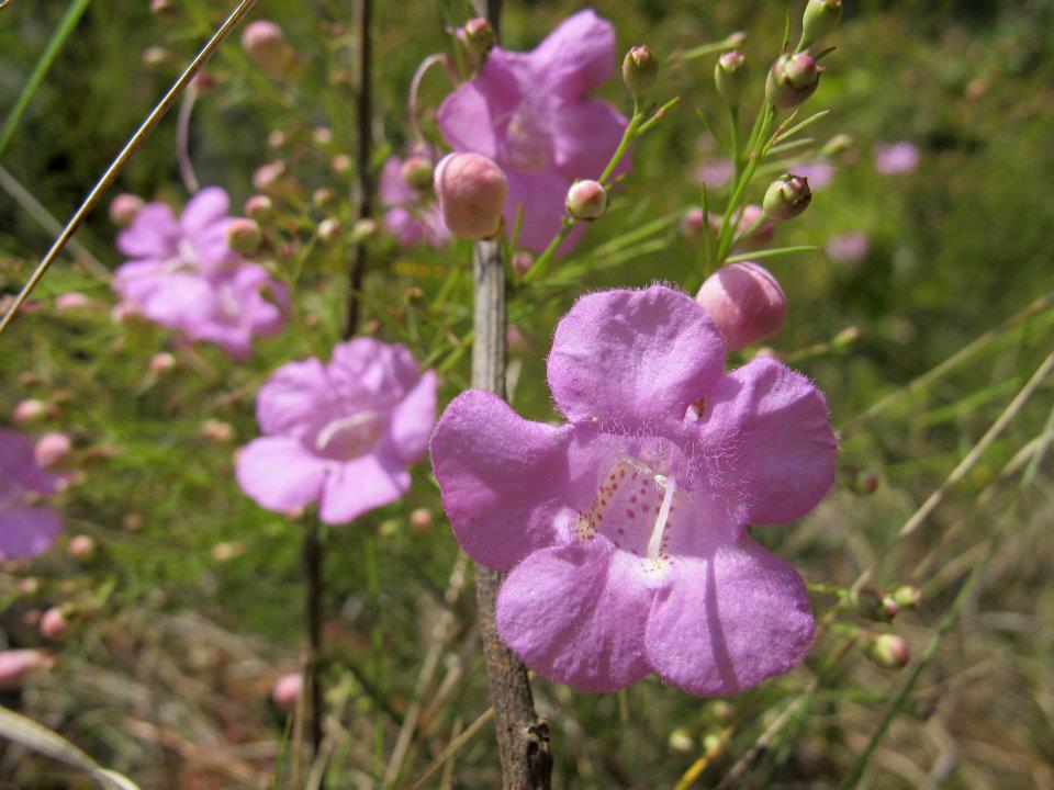
In middle TN we have a globally rare ecosystem called the Limestone Glades. There are species that live here that exist nowhere else in the world. This is called endemism and the central basin has a proportionally high endemism… and is also facing the pressures of explosive growth and development as Nashville takes its turn as the “it city.” For me, these habitats are magical and they allow me to “time travel” hundreds of years into our past where these now-remnants would have been the norm. These habitats are vivid with hues of purple and yellow and hot pinks throughout the year. They’re also harsh and extreme. Flat Rock State Natural Area is a fantastic example, as well as Long Hunter State Park – especially the mountain bike trail (but be wary of mountain bikes and be respectful!)
I used to monitor Tennessee Coneflower and other species in these habitats and it was during the height of summer. The surface temperature of the exposed limestone can get up to over 130 degrees. I loved that work, I loved how harsh it was, how these plants thrived in it and I miss it. Not for everyone.
The East TN parks – especially Roan Mountain around the time the laurels flower are incredible also and just a totally different suite of species to see! I have a fondness for that because I don’t get out there much anymore and miss it greatly.
In West TN, I would say those parks are some of our most underrated. Big Hill Pond State Park is just FUN! Some great trails, the “pond” is fantastic and there’s some super cool flora and fauna out that way – especially if you choose to kayak the Ghost River.
My favorite area of Tennessee though is the Plateau. I can’t describe it really – I’ve just never felt so quite at home as I do wandering the forests of the Plateau. It’s in my retirement plan… special shoutout to Pickett State Park and South Cumberland State Park, but really all the parks on the plateau and the fine staff we have that keep our visitors safe there. It’s incredible and I’d be remiss to not tell our audience what a stellar group our State Park and State Natural Area staff all across the state are. As citizens, we should be especially proud of our of state park system and the staff who manage it.
Q. Can GEO Save the Earth?
I think it’s easy to accuse me of being technocratic and I ponder this often. At the UC plenary this year Jack had a comment to the audience about the Climate Change pickle we find ourselves in – he said it’s a result of a failure to collaborate. He meant, as a global society with a wide range of interests, goals and beliefs we have not been asking questions about how we all interact and impact one another. We lack a shared understanding about each other and about our role in the world and how our social, economic and environmental systems interact with one another. Can Geo save the world? My personal belief is that we cannot innovate our way to a more sustainable future – we must drastically alter our behaviors as a species. However, I believe that geospatial technology is THE ONLY technology that can properly illuminate the shared understanding required for us to move in the direction of a more sustainable future. It is inherently a geographic problem that requires a geographic approach to solve it.
Q. Last question is yours – SAY Anything to the Readers of Geohipster!
was surprised when you asked me to participate in this. Despite being an Esri employee, and a GIS user, I do not consider myself “GIS-first.” I have always considered myself an environmental professional first – one that happens to use GIS to conduct my business. My role is now helping other environmental professionals be successful with the tools to conduct their business.
Right now, the demand for applied environmental knowledge is greater than it ever has been. This is exciting, but it also means that as an industry, we are rapidly evolving, and our skills must evolve with it. My sense from our community is that we’re sick of talking about climate change as an issue, and we’re ready to move forward with taking action. This is the power of geospatial – it empowers us to ask multi-disciplinary questions, collaborate and take real climate action.
This is why it’s so important for us to collaborate across industries and through the use of a common language of geography. It’s why our professional organizations are so important as well. For environmental professionals especially – we’ve been doing classic “desktop GIS” and we were some of the earliest adopters. Now, with these demands on our knowledge, we’re having to embrace web-GIS and be more collaborative. We need our networks of support more than ever, and THAT, ultimately, is my goal at Esri… To foster that community and ensure we’re successful as an industry. So I really appreciate the opportunity to reach the GeoHipster audience! Thank you.